A cadastral survey is a crucial part of modern property management and land administration systems. This specialised type of land surveying accurately determines and records property boundaries, establishing the precise dimensions, area, and location of land parcels.
The main purpose of cadastral surveys goes beyond just marking boundaries. These surveys create detailed records that serve as legal documentation of property ownership, which are essential in:
- Real estate transactions
- Property development planning
- Land dispute resolution
- Infrastructure project management
Property owners and developers need to understand cadastral survey because these documents provide critical legal protection and enable informed decision-making. A proper cadastral survey helps:
- Prevent boundary disputes with neighbouring properties
- Ensure compliance with local zoning regulations
- Support accurate valuation of land assets
- Enable efficient planning for future development
The information from these surveys becomes part of the official land registration system, creating a reliable foundation for property rights and land management in both urban and rural areas.
Understanding Cadastral Surveying
Cadastral surveying is a specific area of expertise within the larger field of land surveying. Its main focus is on determining and recording property boundaries. Unlike other types of surveys, such as topographic surveys that map out natural features or engineering surveys used for construction projects, cadastral surveying has its own unique purpose.
The Origin and Meaning of “Cadastral”
The word “cadastral” comes from the Latin term “capitastrum,” which originally referred to a register of property taxes. A “cadastre” is an official public record or map that provides detailed information about:
- Land parcel boundaries
- Property ownership information
- Land value assessments
- Property dimensions and extent
- Legal rights and interests
This organised documentation of land ownership has been in practice since ancient times. It played a vital role in various areas such as:
- Collecting taxes
- Resolving disputes over boundaries
- Protecting property rights
- Managing land
- Planning urban areas
Key Components of Cadastral Surveying
A cadastral survey involves several important aspects:
Legal Research
This involves studying legal documents related to the property, such as titles and historical survey records. It also includes examining past transactions involving the property and understanding any easements or encumbrances that may affect it.
Field Work
Fieldwork is an essential part of cadastral surveying. Surveyors go out into the field to locate existing boundary markers, measure the dimensions of the property, verify physical features like fences or walls, and document any encroachments (when someone unlawfully intrudes upon another person’s property).
Technical Documentation
After completing the fieldwork, surveyors create detailed plans based on their measurements and observations. They record boundary coordinates using precise instruments, prepare legal descriptions that define the property’s boundaries in words, and develop cadastral maps that visually represent these boundaries.
The practice requires extensive knowledge of:
- Property law principles
- Survey mathematics
- Historical surveying methods
- Modern measurement technologies
- Local regulations and standards
Cadastral surveyors must maintain precise accuracy standards, as their work directly impacts property rights and legal boundaries. This responsibility necessitates the use of sophisticated equipment and adherence to strict professional protocols to ensure the reliability of boundary determinations.
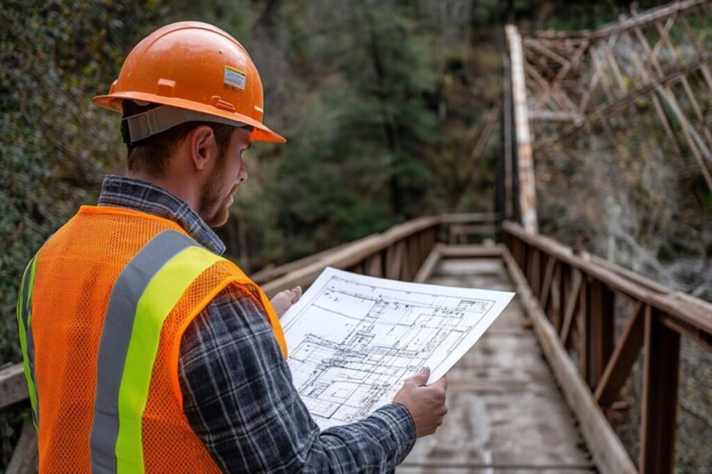
The Process of Conducting a Cadastral Survey
A cadastral survey involves a systematic approach to boundary determination through precise measurements and comprehensive documentation. Licensed cadastral surveyors follow strict protocols to ensure accuracy and legal compliance throughout the process.
Role of Cadastral Surveyors
Licensed cadastral surveyors serve as authoritative experts in boundary determination, bringing technical expertise and legal knowledge to each project. Their primary responsibilities include:
- Examining existing property documentation
- Analysing historical survey records
- Conducting physical site inspections
- Performing precise measurements
- Preparing detailed survey reports
The survey process begins with thorough research of legal documents, including:
- Title deeds
- Property certificates
- Previous survey plans
- Historical maps
- Local council records
Field measurements require advanced technical equipment and methodologies:
- GPS technology – For precise coordinate determination
- Total stations – For accurate distance and angle measurements
- Digital levels – For elevation data collection
- Ground-penetrating radar – For locating buried markers
Licensed surveyors must adhere to strict professional standards and regulations set by governing bodies. This compliance ensures the legal validity of their work and protects property owners’ interests.
The complexity of modern property developments necessitates collaboration with various specialists:
- Utility locators identify underground services
- Town planners provide zoning requirements
- Environmental consultants assess land conditions
- Legal professionals verify property rights
A comprehensive cadastral survey includes:
- Initial site reconnaissance
- Research of existing documentation
- Field measurement collection
- Data analysis and verification
- Survey plan preparation
- Professional certification
The integration of traditional surveying methods with modern technology enables surveyors to:
- Achieve millimetre-level accuracy
- Create detailed digital records
- Generate 3D terrain models
- Produce computer-aided designs
Licensed surveyors maintain professional indemnity insurance and undergo regular training to stay current with industry standards and technological advancements. This commitment ensures the delivery of high-quality, legally compliant survey services that meet modern property development requirements.

Tools and Evidence Used in Cadastral Surveys
Cadastral surveyors use various tools and types of evidence to determine property boundaries accurately. They primarily rely on physical boundary markers as reference points:
- Iron pins/rods – Durable metal markers driven into the ground
- Concrete posts – Permanent monuments with identifying marks
- Natural features – Trees, rocks, or waterways marked as boundary points
- Property corners – Metal caps or discs set in concrete
The process of identifying these markers involves using advanced equipment:
- GPS systems for precise coordinate measurements
- Total stations for angular and distance calculations
- Digital mapping software for data processing
- Ground-penetrating radar to locate buried markers
In cases where original boundary markers are damaged or missing, surveyors must turn to secondary evidence sources. This may include examining historical aerial photographs or referring to old fence lines and walls. Witness statements from long-term residents, previous survey records and field notes, as well as title documents and historical maps also provide valuable information.
Surveyors face the challenge of analysing multiple evidence sources when dealing with missing or damaged monuments. They must assess the reliability of each piece of evidence by considering factors such as:
- Age and condition of existing markers
- Consistency with documented measurements
- Alignment with physical features
- Historical patterns of land use
- Relationship to adjacent properties
Modern cadastral surveys combine traditional methods of marking boundaries with digital technology to ensure accuracy and create permanent records for future reference. For instance, the use of ground-penetrating radar has revolutionized the way surveyors locate buried markers. This technology, along with GPS systems and total stations, allows for precise measurements that were previously unattainable.
Moreover, when faced with challenges such as missing boundary markers, surveyors often rely on secondary evidence sources like historical aerial photographs or previous survey records. These documents not only provide crucial information about property boundaries but also offer insights into historical land use patterns. The importance of these secondary sources is highlighted in a recent study published on ScienceDirect which discusses their role in cadastral surveys here.
In addition, it’s essential for surveyors to maintain a comprehensive record of their findings. This is where digital mapping software plays a vital role in data processing and creating permanent records for future reference. The combination of traditional methods and modern technology ensures that cadastral surveys are not only accurate but also efficient.
Ultimately, the goal of cadastral surveys is to provide clear and accurate property boundaries which can then be used for various purposes including legal disputes, property sales, and urban planning. The tools and techniques employed by cadastral surveyors play a crucial role in achieving this goal.
Importance of Cadastral Surveys in Property Management
Cadastral surveys are crucial in modern property management. They help keep precise land records and make property transactions easier. These surveys provide detailed documentation of property boundaries, which is essential during:
- Property sales and transfers
- Land subdivision applications
- Boundary dispute resolutions
- Infrastructure development planning
Supporting Land Development and Infrastructure Projects
The accuracy of cadastral surveys allows property developers to:
- Create precise plans for subdivisions
- Clearly define property lines for new developments
- Establish easements and rights-of-way
- Identify potential encroachments
These surveys also provide important information for infrastructure projects, especially in telecommunications installations. For instance, when planning new NBN installations, having accurate boundary information helps determine the best location for equipment while respecting property lines.
The impact of cadastral surveys goes beyond just land development. They also play a significant role in various aspects such as:
Construction Planning
- Verifying site boundaries
- Ensuring compliance with building setbacks
- Determining the placement of access roads
- Identifying utility corridors
Land Subdivision
- Ensuring accurate division of parcels
- Designating common properties
- Establishing easements
- Allocating road reserves
Infrastructure Development
- Mapping underground utilities
- Determining the placement of telecommunications equipment
- Planning drainage systems
- Establishing public access routes
The data obtained from cadastral surveys helps avoid expensive errors and legal issues during development projects. By clearly defining boundaries and property rights, these surveys minimise the chances of:
- Delays in construction caused by boundary disputes
- Incorrect placement of utilities
- Issues related to encroachment
- Complications in obtaining planning permission
Professional surveyors collaborate closely with various stakeholders involved in development projects, including:
- Local councils
- Property developers
- Construction companies
- Utility providers
This collaboration ensures that development plans are implemented accurately while also adhering to local regulations and respecting property rights. The detailed measurements and documentation provided by cadastral surveys serve as a solid foundation for successful project execution and effective long-term management of properties.
Professional Services Related to Cadastral Surveys
Cadastral surveying involves a wide range of specialised services that are crucial for effective land management and development. Licensed cadastral surveyors work with established firms to provide comprehensive solutions for property-related issues.
Key Professional Services Include:
- Boundary surveys and re-establishment
- Title investigations and historical research
- Expert witness services for legal proceedings
- Digital mapping and GIS integration
- Construction set-out surveys
- Subdivision design and planning
Professional surveying firms like Wumara Group integrate cadastral services with complementary offerings such as subsurface utility locating. This integrated approach helps prevent potential conflicts during construction projects and streamlines development processes.
Industry Collaboration:
The cadastral surveying profession maintains strong partnerships with:
- Local councils and planning authorities
- Property developers and builders
- Legal practitioners and conveyancers
- Utility companies and service providers
- Indigenous communities for land management
Many firms now offer specialised consulting services supporting Indigenous procurement in major project tendering, reflecting the evolving nature of land management practices in Australia.
Quality Assurance:
Professional cadastral surveying services adhere to:
- State-specific surveying regulations
- Industry best practices and standards
- Regular professional development requirements
- Quality management systems
- Environmental protection guidelines
These professional services form the backbone of reliable property development and infrastructure projects across both urban and regional areas.
See Also : Boundary Surveyors: Working with Utility Locators for Accurate Results
Professional Services Related to Cadastral Surveys
Professional surveying companies provide comprehensive cadastral services essential for property and infrastructure development. The Wumara Group exemplifies modern surveying practices by offering integrated solutions that combine:
- Registered cadastral surveying
- Subsurface utility detection
- Indigenous procurement consulting
These integrated services create a streamlined approach to project management. Subsurface utility locating services work hand-in-hand with cadastral surveys to:
- Identify underground infrastructure
- Prevent costly service strikes
- Map existing utilities for future reference
- Support informed decision-making during development
The inclusion of Indigenous procurement consulting brings additional value to major infrastructure projects. This specialised service helps:
- Meet government tender requirements
- Create opportunities for Indigenous businesses
- Ensure cultural considerations in land development
- Build sustainable community relationships
Leading firms maintain strict quality standards through:
- Licensed professional surveyors
- State-of-the-art equipment
- Regular staff training
- Adherence to industry regulations
This commitment to quality is reflected in the rigorous processes outlined in documents such as the CPQ Manual which provides detailed guidelines for procurement processes.
The combination of these services enables efficient project delivery across various sectors:
- Telecommunications infrastructure
- Government facilities
- Commercial developments
- Residential subdivisions
This integrated approach has proven particularly valuable for complex projects requiring multiple specialist services under single project management, such as those detailed in the RFQ document which outlines specific requirements and expectations for such projects.
Regional Relevance & Client Feedback
Cadastral survey services across New South Wales and Queensland demonstrate strong market presence and client satisfaction. Recent projects showcase the breadth of expertise in these regions:
Telecommunications Infrastructure Projects:
- Successful completion of boundary surveys for Telstra tower installations
- NBN Co. infrastructure placement requiring precise property line determinations
- City of Sydney Council telecommunications upgrades
Client Satisfaction Highlights:
“The team’s responsiveness and attention to detail made our property development process seamless” – Major Property Developer, NSW
The NSW and QLD surveying market benefits from competitive pricing structures and negotiable rates, making professional cadastral services accessible to various project scales. Client feedback consistently emphasises:
- Quick response times to enquiries
- Professional and friendly service delivery
- Cost-effective solutions
- High-quality documentation
Recent collaborations with School Infrastructure NSW (SINSW) on state government projects highlight the capability to handle complex institutional requirements. The combination of technical expertise and client-focused service delivery has established strong relationships with both public and private sector clients across these key Australian markets.
A proven track record in these regions demonstrates the ability to meet diverse surveying needs while maintaining high standards of accuracy and reliability in cadastral work.
Conclusion
Cadastral surveys are essential for modern property management and land development systems. These specialised surveys create precise boundary definitions that protect property rights and establish clear ownership records. The detailed documentation produced through cadastral surveying enables efficient urban planning, infrastructure development, and property transactions.
The impact of cadastral surveys extends beyond individual property owners to shape entire communities. These surveys provide essential data for:
- Property subdivision and development projects
- Infrastructure planning and construction
- Public land management
- Economic growth through secure property markets
The combination of technical expertise, legal knowledge, and advanced surveying tools makes cadastral surveys indispensable for:
- Maintaining accurate property records
- Resolving boundary disputes
- Supporting land development initiatives
- Protecting landowner interests
The role of cadastral surveys continues to evolve with technological advancements, yet their fundamental purpose remains unchanged – providing reliable boundary definitions that safeguard property rights and enable strategic land use planning.